


Because Three Mountains Come With the Address
Part of the Why Issaquah? series: Because Three Mountains Come With the Address
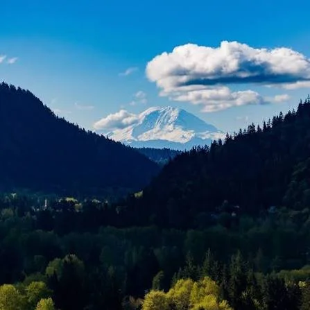
Photo of mountains facing south from Issaquah, WA
Cougar, Squak, and Tiger, the three peaks locals call the "Issaquah Alps," wrap around the city on three sides, and together they hold well over 100 miles of trail. That's not a stat you find attached to most suburban addresses. It means that depending on which neighborhood you're in, a genuine mountain trailhead might be a five-minute drive, or in some cases a walk, from your front door.
A Different Trail for a Different Mood
Cougar Mountain Regional Wildland Park, on the city's western edge, is the largest of the three and feels the most remote: old-growth remnants, abandoned coal mine sites, and enough mileage that you can genuinely get turned around if you're not paying attention. Squak Mountain State Park, tucked between Cougar and Tiger, is the quieter middle child, popular with trail runners who want climbs without crowds. And Tiger Mountain State Forest, home to Poo Poo Point and dozens of other named trails, is the workhorse of the three, with options ranging from a stroller-friendly loop to a genuine all-day mountain hike.
Down in the valley, Lake Sammamish State Park adds the water side of the equation: nearly two miles of shoreline, swimming beaches, picnic areas, and boat and paddleboard launches, all inside a ten-minute drive of most Issaquah neighborhoods.
Why Buyers Keep Bringing This Up
For a lot of relocating families, this is the single biggest lifestyle upgrade Issaquah offers over a more built-out Eastside city: the outdoors isn't something you plan a trip toward, it's something you're already inside of. Dog owners, trail runners, and parents of active kids tend to name this specifically when asked why they chose Issaquah over Bellevue or Redmond, not because those cities lack parks, but because Issaquah's access is bigger, wilder, and closer, all at once.
For Buyers & Sellers
Distance to a named trailhead, Cougar, Squak, or Tiger Mountain, is a detail worth pulling out explicitly in listing copy, the same way you'd note a school boundary or a commute time. Buyers relocating for lifestyle reasons are often searching by trail name, not just neighborhood name.
If getting a mountain trailhead within walking or short driving distance is a priority for your next home, let's build your search around it. Reach out to Kelly Azzarello Real Estate and we'll map out which Issaquah neighborhoods put the Alps closest to your door.


Because Lake Sammamish State Park Is the Backyard Everyone Shares
Part of the Why Issaquah? series: Because Lake Sammamish State Park Is the Backyard Everyone Shares
Why Issaquah? Because Lake Sammamish State Park Is the Backyard Everyone Shares
Category: Parks & Recreation | Suggested length: 750–850 words | Target reader: families, boaters, youth-sports parents
📷 PHOTO PLACEHOLDER: Tibbetts or Sunset Beach at Lake Sammamish State Park, and the ISC soccer fields in use.
If the Issaquah Alps are the vertical side of outdoor life here, Lake Sammamish State Park is the horizontal one: 512 acres of beach, ballfields, trails, and open water sitting right at the north edge of town, where Issaquah Creek empties into the lake. Established in 1950 and run by Washington State Parks, it's one of the most heavily used state parks in the system, and it's easy to see why once you've spent an afternoon there: there's genuinely something for almost everyone within a few hundred yards of the parking lot.
Two Beaches, a Boat Ramp, and Real Waterfront
The park holds nearly 7,000 feet of Lake Sammamish shoreline, split between Tibbetts Beach and Sunset Beach, both with swimming areas, and both an easy walk from parking. On the far side of Issaquah Creek, a separate area holds the boat launch, the only public boat ramp access to Lake Sammamish, along with trails through quieter wetland and forest habitat where great blue herons nest. Between the beaches and the launch, the park covers pretty much every way people actually use a lake: swimming, paddleboarding and kayaking, waterskiing and motorized boating, or just a picnic table with a view.
The Fields Where Half the Neighborhood's Kids Grew Up Playing
West of the creek, the park's athletic complex is where a huge share of Issaquah's youth sports actually happen. By field type:
Soccer fields: 9, under a long-term lease held by the Issaquah Soccer Club (ISC Gunners), among the finest grass playing surfaces in the region. ISC funds a dedicated maintenance crew to keep them that way.
Baseball/softball fields: present at the complex, though we couldn't pin down an exact current count from any source; confirm with the park or the city before publishing a specific number.
This is home turf, literally, for ISC. From spring through early fall, these fields are where a huge share of Issaquah's youth soccer actually happens, before the club moves to turf fields around town for the wetter months. If you've ever wondered where all those team photos in soccer uniforms around Issaquah get taken, there's a good chance it's right here.
More Than a Sports Complex
The park is also where the town shows up for its bigger community moments: the Issaquah Rotary Club's "Run With the Fishes" 5K and 10K follows the shoreline and parallels Issaquah Creek each fall, timed to the salmon run, and ongoing habitat restoration work along the creek (a partnership between State Parks and the Mountains to Sound Greenway Trust) has been steadily improving both water quality and the salmon spawning grounds within the park itself. Add in an accessible playground near Sunset Beach, reservable picnic shelters, and an ADA-compliant trail network, and it's easy to understand why a park this size, this close to downtown, functions as a genuine backyard for the whole city rather than just a weekend destination.
For Buyers & Sellers
For families with kids in club or rec soccer, proximity to Lake Sammamish State Park's fields can meaningfully shape weekly logistics for a big chunk of the year. It's worth asking buyers directly whether that's a priority. For boat owners, being minutes from the only public launch on the lake is a genuine amenity, not just a nice-to-have, and should be called out specifically in listings near the NW Sammamish Road corridor.
Curious which Issaquah streets put you closest to the beaches, the boat ramp, or the soccer fields your family actually uses? Reach out to Kelly Azzarello Real Estate and we'll map it out.
Kelly Azzarello Real Estate | Compass
📧 kelly@kellyazzarello.com | 📞 (425) 830-6457 | 🌐 kellyazzarello.com
Note: Soccer field count (9) sourced directly from the Issaquah Soccer Club's own site (iscgunners.org/fields), more current than the previously cited Wikipedia figure. Softball field count not confirmed from any source; get the exact number from WA State Parks or the city before publishing.

Because the View From Poo Poo Point Never Gets Old
Part of the Why Issaquah? series: Because the View From Poo Poo Point Never Gets Old
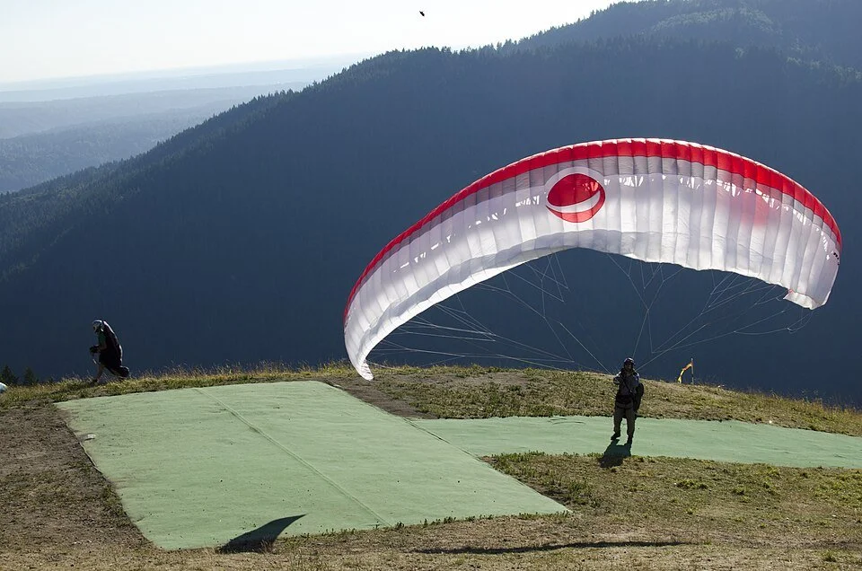
Ask a longtime Issaquah resident what makes this city different from anywhere else on the Eastside, and there's a decent chance the answer involves a hillside covered in colorful nylon wings. Welcome to Poo Poo Point, the summit on West Tiger Mountain where hikers earn a jaw-dropping view of Mount Rainier and Lake Sammamish, and where, on a clear day, you'll watch paragliders run straight off the grassy knoll and disappear into the sky.
A Trailhead That's Basically a Neighborhood Amenity
Most cities point to a park. Issaquah points to a mountain. The Chirico Trail climbs about 1,700 feet over roughly 3.8 miles round trip, steep enough to feel like an accomplishment, short enough to knock out before lunch. The longer, gentler route starts right from Issaquah High School, which tells you everything about how woven into daily life this trail really is. Kids grow up here treating a 4-mile mountain hike the way other towns treat a walk around the block.
The name itself is local lore: it's said to come from the steam whistle sound of old logging equipment that once worked this hillside, not the joke every second-grader assumes. Around the 1970s the timber company cleared the summit so thoroughly that the open, grassy launch point was born, and pilots noticed. Tiger Mountain has since become one of the best-known paragliding and hang-gliding sites in the country, with a local outfitter running tandem flights right from the base.
You Don't Have to Fly to Love It Up There
Here's the part that surprises newcomers: most of the people at the top on any given weekend aren't gliding at all. They're hikers who came specifically to watch. Poo Poo Point has two separate viewpoints, the South Launch and the North Launch, both of which double as some of the best spectator seating in the state. Families spread out a picnic on the grassy knoll, dogs nap in the sun, and everyone watches for that moment when a pilot takes a few running steps and simply lifts off the hillside. It's become its own kind of local ritual: a genuinely free, genuinely spectacular way to spend a Saturday morning, whether or not you have any interest in leaving the ground yourself.
The Company Behind the Wings: Seattle Paragliding
If watching from the grass turns into wanting to try it yourself, the outfitter most pilots and first-timers know by name is Seattle Paragliding, based right at the foot of Tiger Mountain on Issaquah-Hobart Road, next to the landing zone. They offer tandem flights with a certified instructor pilot doing all the technical work. No experience, and essentially no age limit, required; they've flown passengers from age 5 to well into their 90s. You either ride their shuttle up to the launch or hike up yourself and pay a smaller fee to have your gear shuttled, then run a few steps downhill with your instructor and the wing does the rest. Beyond one-time tandem flights, they also run a full paragliding school for people who want to get certified and fly solo, complete with a private training hill, plus tandem "party" packages for groups. For a lot of visitors, watching from Poo Poo Point on one trip and booking a flight on the next is basically the Issaquah bucket-list arc.
What It's Really Selling: Proximity to the Extraordinary
Here's the thing buyers relocating from denser markets don't always expect: this isn't a drive-an-hour-to-the-trailhead kind of outdoor access. Poo Poo Point, and the rest of the Issaquah Alps, sit inside the city limits or a few minutes past them. You can have a normal Tuesday and be standing on a ridgeline watching someone launch off a mountain by 6 p.m.
For buyers weighing Issaquah against other Eastside cities, this is often the tiebreaker. It's not just that there's a trail nearby. It's that the trail is dramatic, the payoff is real, and it's part of the identity of the place rather than an afterthought.
For Buyers & Sellers
Homes within easy reach of the Poo Poo Point / Tiger Mountain trailheads, particularly in the Issaquah Highlands and neighborhoods off Newport Way and SE Issaquah-Fall City Road, consistently draw buyers who list "outdoor access" as a top priority. If you're selling in one of these pockets, it's worth calling out trail proximity explicitly in your listing; it's a detail relocating buyers search for by name.
Thinking about a move to a neighborhood where a mountain view, or a mountain launch pad, is part of daily life? We'd love to show you around. Reach out to Kelly Azzarello Real Estate to talk about which Issaquah neighborhoods put you closest to the trails that matter most to you.
Kelly Azzarello Real Estate | Compass
📧 kelly@kellyazzarello.com | 📞 (425) 830-6457 | 🌐 kellyazzarello.com

14: Lakes of Sammamish: Where to Swim, Fish, Paddle, and Live on the Water
Lake Sammamish, Pine Lake, Beaver Lake, Yellow Lake and a few you can't see from the road: who can use each one, the rules in one line, and what it means if you want to live on the water.
Lakesof Sammamish: Where to Swim, Fish, Paddle, and Live on the Water
The city is named for a lake, but Lake Sammamish is only part of thewater story. Up on the plateau itself there are three smaller lakes,Pine Lake, Beaver Lake, and Yellow Lake, and each has a very differentrelationship with the people around it. Pine Lake has a city park andseasonal lifeguards. Beaver Lake has a lodge and a rack of free loanerlife jackets. Yellow Lake sits inside Klahanie, where access is ahomeowners’ association question.
That’s the real question with Sammamish’s lakes: not which one isprettiest, but who is allowed to use it. Some are public, some areresident-only, and a few are hard to spot from the road. Below is eachlake, its rules in one line, and, at the end, what it means if you wantto live on the water instead of just visiting.
Lake Sammamish
The big one. Lake Sammamish covers roughly 4,850 acres, withSammamish along its eastern shore, Issaquah at the south end, andRedmond and Bellevue to the north and west. Most of the shoreline isprivate, so the handful of public access points matter:
Sammamish Landing (Sammamish). An 8-acre park onthe eastern shore with three small beaches, two docks, a picnic shelter,and a display on the railroad that once ran along today’s East LakeSammamish Trail. It’s the only public property on the lake’s shorelineinside Sammamish city limits.
Lake Sammamish State Park (Issaquah). The lake’ssouth end, and the main public boat launch. It also has swimming beaches(Tibbetts and Sunset), picnic shelters, and athletic fields.
Idylwood Park (Redmond). Public access on thelake’s west shore.
At the north end, Marymoor Park in Redmond is where the 11-mile EastLake Sammamish Trail begins, a flat paved ride or walk along the waterthat comes up again and again in what people love about living here.
For anglers, wild coastal cutthroat, smallmouth bass, and yellowperch are the main draws. Kokanee, the lake’s landlocked sockeye, spawnin creeks like Laughing Jacobs, Tibbetts, and Issaquah Creek, and areclosed to fishing.
The rules, in one line: swim only at designatedbeaches (Sammamish Landing or the state park), launch boats at the statepark (fees apply), and check WDFW’s current rules before fishing, sincekokanee, steelhead, and some salmon are closed.
Pine Lake
Pine Lake is Sammamish’s most neighborhood-scale lake: a small lakewith a city park on its shore and homes around it. Pine Lake Park hassandy beaches, a designated swimming area, and calm water for kayaks andpaddleboards, and it’s a good example of what the plateau’s lake parksdo well. We introduced the Pine Lake neighborhood in 8Sammamish Neighborhoods Worth Knowing.
The rules, in one line: swim only in the designatedarea (lifeguards are on duty only during specific summer weeks), andfishing season runs from the fourth Saturday in April through October31, with a license.
Beaver Lake
Beaver Lake is actually a chain of three lakes, and the main lake iswhere the recreation happens. Beaver Lake Park covers 83 acres, with aswimming area, forested trails, a big meadow, and the historic BeaverLake Lodge, which began as a private resort in the 1930s. In summer thepark lends out life jackets for free, and the lake hosts the swim leg ofthe annual Beaver Lake Triathlon. One quirk: the public boat ramp isn’tin the park, it’s a state Fish & Wildlife access site on the lake’ssoutheast side. We covered the park in more detail in GettingOutside in Sammamish.
The rules, in one line: swim in designated areas,borrow the free life jackets in summer, fish year-round with a license,and use electric motors only, since gas motors aren’t allowed on thelake.
Yellow Lake
Yellow Lake is tucked into Klahanie beside Klahanie Park. It’s small,about 10 acres, and named for its yellow water lilies. A forested buffersurrounds it and a walking trail circles it, so it functions more asurban wildlife habitat than a swimming hole. It’s shallow and edged withlily pads, so don’t picture a beach.
Ownership and access are worth confirming rather than assuming.Reports describe the lake as owned by the Klahanie HOA, and the trail’sstatus isn’t as clear-cut. The Klahanie HOA can tell you what’s open tonon-residents: klahanie.com.
The rules, in one line: treat it as resident-onlyunless the HOA says otherwise, and don’t assume any swimming, fishing,or boating access.
The lakes you’ll hearabout but rarely see
Laughing Jacobs Lake. It’s the source of LaughingJacobs Creek, which runs through Sammamish and Issaquah to LakeSammamish. Below the creek’s falls is a primary spawning ground for thebig lake’s kokanee. The lake itself is reportedly private, so this oneis a story rather than a destination.
Ames Lake. It sits north of the city inunincorporated King County, near Union Hill-Novelty Hill. It shows up onregional maps, but we couldn’t confirm public access details, so ifyou’re house hunting up north, ask about it by address.
Ebright Creek Park. It’s not a lake, but thisneighborhood park has trails and a creek, and it’s a good stop for waterwithout a beach.
If you want to live on thewater
“Lake living” in Sammamish can mean three different things, and theprice, permits, and day-to-day experience differ a lot between them.
True waterfront. The property touches theshoreline, usually with a dock. You’ll find these on Lake Sammamish’seast shore, Pine Lake, and Beaver Lake. Frontage and views command apremium, and docks, lifts, and shoreline improvements add both lifestyleand regulatory complexity. It isn’t unusual to see a Beaver Lake listingwhere the frontage is tied to a shoreline variance.
Deeded or HOA lake access. The home isn’t on thewater, but the owners get access through an easement or acommunity-owned park or beach. Several developments around LakeSammamish own small private parks for residents. This can be the mostaffordable way to have a dock or beach, but the details live in thelegal documents, so read them.
Lake-adjacent. You live near the water and use thepublic parks: Pine Lake Park, Beaver Lake Park, Sammamish Landing, orthe state park. Because most of the shoreline is private, these publicaccess points are the whole story for many households.
Before you buy on or near a lake, ask about:
The dock’s permit history, and whether it’s allowed to stay asis.
The exact wording of any water-access easement or HOA beachrights.
Whether the lot sits in a mapped flood area, and whether floodinsurance will be required.
Shoreline rules that could limit a remodel, addition, or newdock.
The lake’s own rules: Beaver Lake, for example, allows electricmotors only.
Not sure which of the three fits? Tell us how you’d use the water,and we’ll search accordingly.
Helpful links
Cityof Sammamish Parks & Trails, for current hours, lifeguard weeks,and swimming rules
BeaverLake Park & Lodge, including the life jacket program
SammamishLanding Park
WDFW:Lake Sammamish and BeaverLake, for fishing rules and access
Where they sit
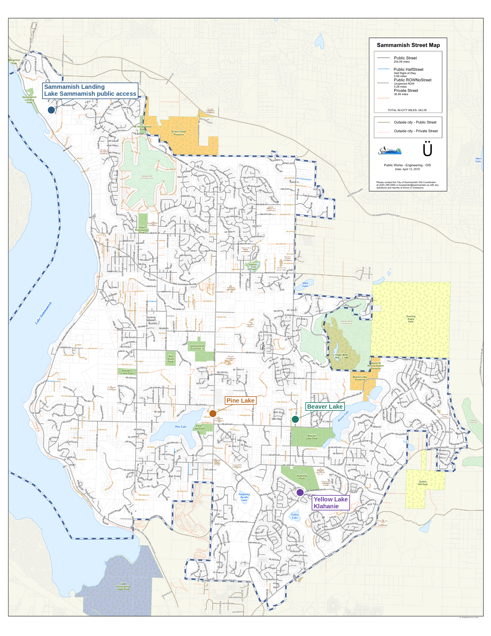
Official City of Sammamish street mapannotated with callouts for Sammamish Landing on Lake Sammamish, PineLake, Beaver Lake, and Yellow Lake in Klahanie
Base map: City of Sammamish Public Works – Engineering – GIS,Sammamish Street Map (April 13, 2016). Callouts and markers added by us,plotted from real coordinates; not an official city product.
This is a supplementary post in our Why Sammamish?series.
Kelly Azzarello Real Estate | Compass 📧 kelly@kellyazzarello.com 📞(425) 830-6457 🌐 kellyazzarello.com

10: Duthie Hill Mountain Bike Park
Duthie Hill isn’t a neighborhood park with a bike rack, it’s a genuinely world-class, purpose-built mountain bike park. Here’s what’s actually there, who can ride, and how to get in.
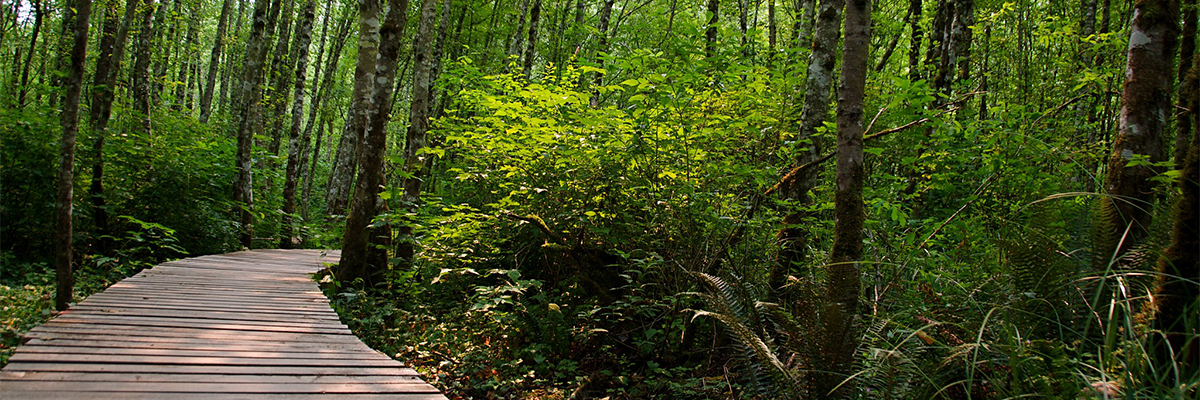
Duthie Hill Mountain Bike Park - King County Parks
A Plateau Amenity Worth Knowing
We’ve mentioned Duthie Hill a few times already in this series, in the outdoor life post and again in the Trossachs neighborhood spotlight, and it deserves its own closer look. This isn’t a neighborhood park with a bike rack. It’s a genuinely world-class, purpose-built mountain bike park that draws riders from across the region, and it sits close enough to Sammamish’s southeastern edge that it functions as a real amenity for the plateau even though it’s technically just outside city limits.
What’s actually there
Duthie Hill covers 120 acres of dense evergreen forest, Douglas fir and western hemlock, with well-draining soils that keep it rideable close to year-round. The trail layout is distinctive: a six-mile network of rolling singletrack forms a four-leaf clover shape around a 2.5-acre central clearing. That clearing is the social hub of the park, with informational kiosks, skill-building features, a picnic shelter, and an engraved donor bench.
Inside each of the four “cloverleaf” lobes, riders find downhill-only freeride trails loaded with berms, jumps, and drop-offs, each lobe has its own character and difficulty range. The outer, cross-country style trails ring the whole park and are shared, one-way, and open to hikers and trail runners as well as bikers.
[PHOTO PLACEHOLDER: a jump line or berm feature, to show the freeride side of the park]
Trail breakdown
A few of the named trails riders navigate by, with approximate length and difficulty:
• Braveheart — advanced, 0.39 miles. The only advanced-rated cross-country trail at Duthie, mostly fast and flowy with a rock garden entrance and an off-camber root roll that bumps up the difficulty.
• Step It Up — intermediate, 1.3 miles. One of the longer cross-country style trails, fast and flowy with optional skinnies and log rides along the way.
• Movin’ On — intermediate, 0.83 miles. More technical than Step It Up, with tight turns, ladders, bridges, and skinnies throughout, a good training trail.
• Ryans — intermediate, 0.29 miles. Short, fun, and flowy.
• The Great Space Coaster — advanced, a feature-rich trail branching off “Bootcamp” with North Shore-style ladder bridges and skinnies, a real test of balance.
Beyond the park boundary itself, Grand Ridge Park connects directly to the south with its own popular cross-country riding, and the trails at Soaring Eagle Regional Park are accessible less than 2 miles to the north.
[PHOTO PLACEHOLDER: a technical feature like a skinny, ladder bridge, or log ride from the central clearing skills area]
Who built it, and who takes care of it
Duthie Hill was designed and built by the Evergreen Mountain Bike Alliance in partnership with King County, funded through King County’s Community Partnerships and Grants program along with Youth Sports Facilities grants, roughly $225,000 in private donations, and thousands of hours of volunteer labor. Phase 1 opened in 2010; Phase 2 completed in May 2012. The park now sees an estimated 100,000 rider visits a year, and Evergreen continues to maintain the trails through ongoing volunteer stewardship.
The Evergreen Mountain Bike Festival is held at Duthie every June and draws riders from across the region for a full day of racing, demos, and community events.
Who can ride, and the rules that keep it working
Duthie Hill is genuinely built for every skill level, from kids on push bikes learning to balance in the clearing to expert riders chasing the advanced lines. A few rules worth knowing before a first visit:
• All trails are one-way. Signage at each trailhead marks direction, and the whole system depends on everyone riding the correct way.
• The cross-country and perimeter trails are shared with hikers and trail runners; the downhill freeride trails inside each cloverleaf are bike-only.
• No overnight parking. The lots are day-use only.
• Pack out your trash. Facilities are minimal beyond a single restroom near the main lot.
• Evergreen’s youth and teen dirt camps require full-face helmets for advanced sessions, a good baseline expectation for anyone riding the more technical freeride lines, even outside a formal class.
Evergreen also runs a full slate of classes and camps at Duthie, from beginner-level youth dirt camps (ages 8 to 13) through intermediate and advanced teen and adult sessions, plus skills clinics for riders looking to progress. Scholarships are available for camps based on financial need.
Accessibility and adaptive riding
Worth being upfront about what this is and isn’t: Duthie Hill is natural-surface singletrack throughout, not a paved trail, and it isn’t a standard wheelchair-accessible path the way sections of the Sammamish River Trail or Cedar River Trail are. That said, it’s become a genuine, well-documented destination for adaptive mountain biking, more so than most parks in the region.
Evergreen Mountain Bike Alliance launched an Adaptive Mountain Bike (aMTB) program a few years back in partnership with Outdoors for All, a Seattle-based nonprofit founded in 1979 that provides adaptive outdoor recreation for children and adults with disabilities. Outdoors for All runs a beginner mountain biking series at Duthie Hill specifically, using electric-assist adaptive mountain bikes, handcycles, prone cycles, and recumbent trikes, alongside standard two-wheeled bikes, for riders who are already comfortable on a bike but new to mountain biking. Registration is required and eligibility criteria apply; details are on the Outdoors for All website.
On the trail-building side, Evergreen’s crews have been physically modifying parts of Duthie, widening the Bootcamp trail in particular, using what they call “universal trail design”: removing pinch points and cutting brush wider, without changing the character or difficulty progression of the trail itself, so a broader range of equipment can actually ride it. New connector trails added in recent years also mean riders can get from the parking lot to the central clearing entirely on trail, without using the access road, which matters for anyone for whom the road shoulder isn’t a safe or practical option.
King County Parks has highlighted Duthie Hill directly in its own accessibility materials as a place where adaptive mountain biking is demonstrated in practice, which is a meaningful acknowledgment for a park that started out built purely for traditional two-wheeled riding.
Getting there
The park sits on the Sammamish Plateau at the Issaquah-Fall City Road entrance, with a roughly 74-vehicle parking lot on the north side of the road. King County Metro routes 269 and 554 stop on Issaquah-Pine Lake Road SE nearby, so it’s reachable without a car for riders coming from elsewhere on the plateau. On busy weekends, overflow parking has historically been available at nearby schools, though that’s worth confirming directly with Evergreen or King County before counting on it.
The layout, at a glance
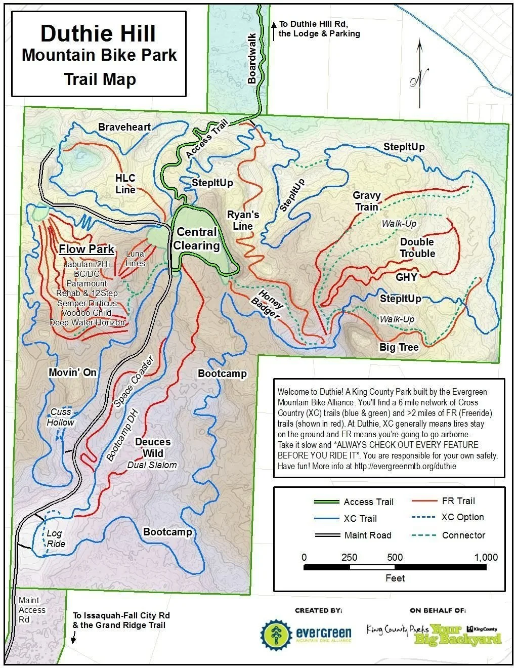
Map courtesy of King County Parks and Evergreen Mountain Bike Alliance.
This is a supplementary post in our Why Sammamish? series, expanding on a landmark first mentioned in our outdoor life post and our Trossachs neighborhood spotlight.
Kelly Azzarello Real Estate | Compass 📧 kelly@kellyazzarello.com 📞 (425) 830-6457 🌐 kellyazzarello.com

05: Getting Outside in Sammamish
Between city parks, county preserves, three lakes, and an internationally recognized mountain bike park, Sammamish’s outdoor life is baked into the geography. Here’s the full rundown.
Sammamish’s outdoor life isn’t an afterthought, it’s baked into the geography. The city sits on a plateau bounded by a lake on one side and a valley on the other, and between city parks, county preserves, and a genuinely world-class mountain bike park, there’s a lot to do without ever getting in the car.
Sammamish Commons
Sammamish Commons is the closest thing this city has to a downtown, and it’s a natural place to start. City Hall, the library, sport courts, a splash pad open Memorial Day through Labor Day, a weekly farmers market, and the city’s Fourth on the Plateau celebration all happen on the same civic green space, with the Sammamish Community YMCA right there too.
Youth sports, well covered
Soccer and baseball are the best-served sports in Sammamish, with multiple organizations covering every level of commitment: Issaquah FC for soccer, Eastlake Little League for baseball, plus Eastlake Youth Football and Eastlake Youth Lacrosse. The Sammamish Community YMCA adds recreational leagues in basketball, volleyball, and more, alongside a full-size lap pool, gymnasium, and an outdoor water slide. The Boys & Girls Clubs of King County run additional year-round leagues in basketball, volleyball, flag football, track and field, and baseball, with summer sports camps. Sammamish itself doesn’t host many dedicated club teams, so families chasing a serious competitive club program, in swimming, soccer, basketball, and volleyball especially, typically end up in Issaquah’s or Redmond’s club systems instead, an easy enough drive, but worth knowing going in.
Cricket has a real, organized presence here too, at both the youth and adult level. Lake Sammamish State Park has two dedicated cricket fields used by adult leagues including the Northwest Cricket League and Washington Cricket League, and youth cricket runs through the Seattle Youth Cricket League, which uses grounds at Klahanie Park and Eastlake High School in addition to the state park fields. It’s a good example of how the city’s park system has grown to match the interests of its genuinely international community.
A trail network that actually connects
The backbone is the East Lake Sammamish Trail, an 11-mile paved, multi-use path running along the lake’s eastern shore from Marymoor Park in Redmond, through Sammamish, down to Issaquah. It’s flat, easy, and about as central to daily life here as a road, people use it to walk the dog, commute by bike, or just get outside for twenty minutes after work.
Beyond that paved spine, Sammamish backs up to a genuinely large amount of forested open space:
Soaring Eagle Regional Park, 600 acres with about 12 miles of trails through mature forest, land that’s been used as a travel corridor for thousands of years. It’s popular with both hikers and mountain bikers, and the trails range from a quarter-mile stroll to a 6-mile loop.
Evans Creek Preserve, a 179-acre former farm restored into meadow, wetland, and forested upland trails through more than 6,500 volunteer hours of restoration work. Boardwalks cross the wetter sections, and it’s an easy, family-friendly walk.
Big Rock Park, smaller and more tucked into a residential neighborhood, with a well-loved treehouse, garden, and a network of trails leading up to the namesake rock outcropping.
Three lakes built for summer
Lake Sammamish State Park, 500 acres at the south end of the lake, with two swimming beaches, picnic areas, a boat launch, and paddleboard and kayak rentals on site.
Pine Lake Park, smaller and more neighborhood-scaled, with a lifeguarded swimming area in summer, a fishing pier, and a soccer field and basketball court alongside the water.
Beaver Lake Park, covered in more depth in our neighborhoods post, rounds out the trio: 83 acres with year-round fishing, a free lifejacket loaner program in summer, a non-motorized boat launch, a large fenced off-leash dog area, and its own forested trail loop. The historic Beaver Lake Lodge, a holdover from the site’s resort era, still stands and is available for private event rentals.
A genuinely world-class mountain bike park
Duthie Hill Mountain Bike Park deserves its own mention. It’s 120 acres of purpose-built trails, roughly 9 miles worth, built and maintained by the Evergreen Mountain Bike Alliance through years of volunteer labor, and it has real international recognition as one of the best purpose-built trail networks in the Pacific Northwest. There’s a full progression here: smooth, flowy cross-country routes with bermed turns for beginners, all the way up to technical rock gardens, drops, and jump lines for advanced riders, plus regular skills clinics for kids. It sits just outside city limits on Issaquah-Fall City Road, close enough that it functions as a Sammamish amenity in every practical sense.
Golf, at three very different clubs
Sammamish has an unusual concentration of private golf for a city this size. Sahalee Country Club has hosted a PGA Championship and other major tournaments on its 27 holes of Ted Robinson-designed fairways. Aldarra Golf Club, on the site of the old Boeing family cattle farm, is a Tom Fazio design known for its condition and Cascade views. The Plateau Club rounds out the trio as a third private option on the plateau. None of these are public-access courses, but their presence shapes the character of the neighborhoods built around them, Sahalee and Aldarra both.
Where it all sits
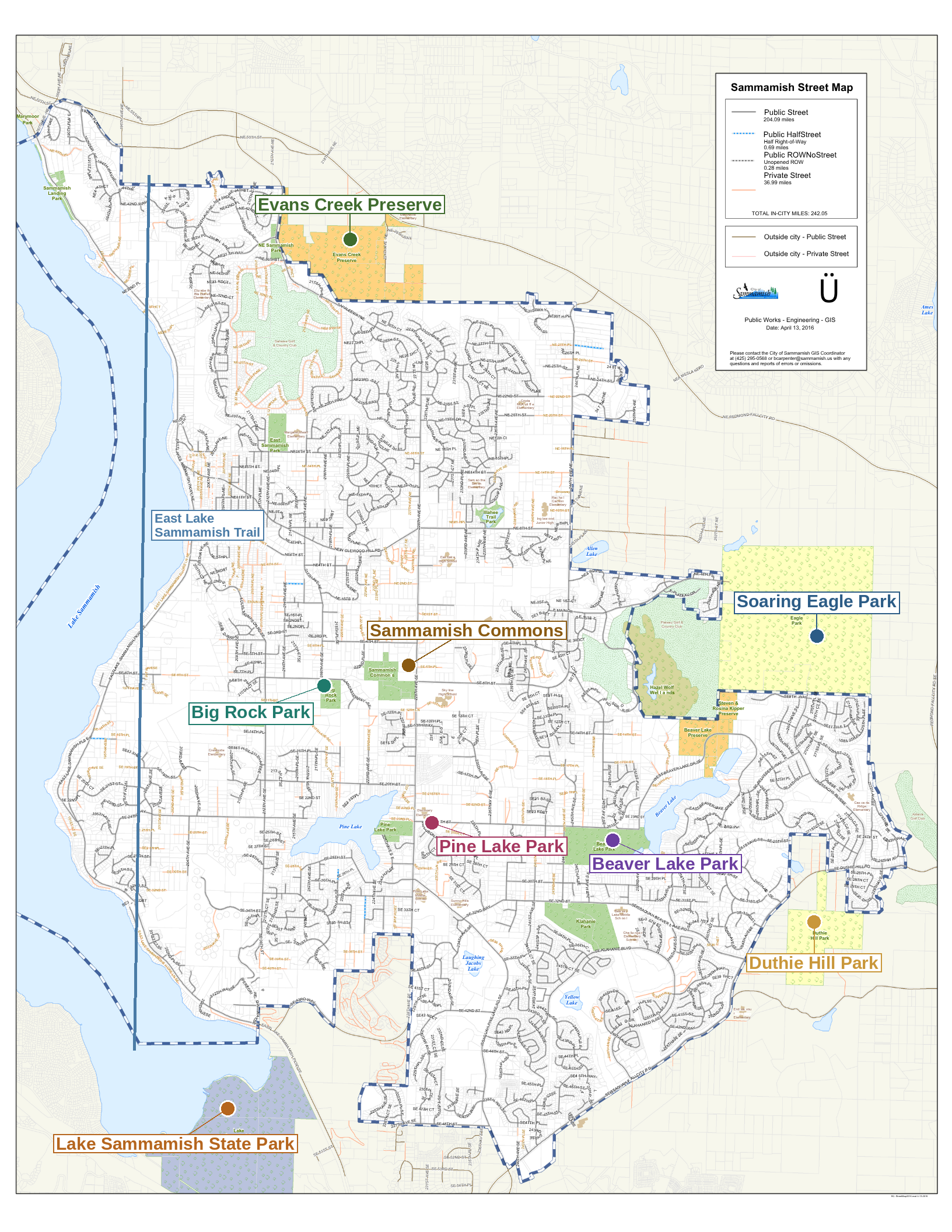
This is the fifth post in our Why Sammamish? series. Up next: the top community events that bring the plateau together each year.
Kelly Azzarello Real Estate | Compass 📧 kelly@kellyazzarello.com 📞 (425) 830-6457 🌐 kellyazzarello.com